Current Conditions
♦
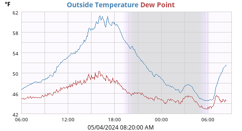
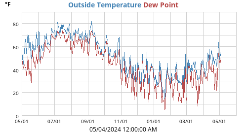
| Outside Temperature | 75.6°F |
| High: Low: |
75.7°F at 09:34:57 AM 61.1°F at 05:50:49 AM |
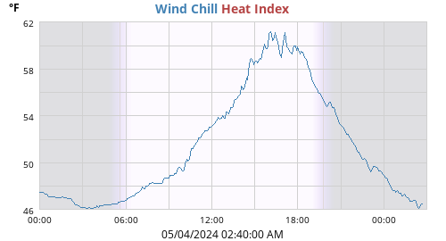
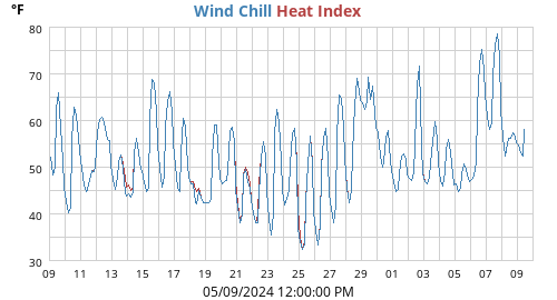
| Heat Index | 75.6°F |
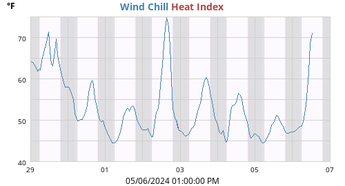
| Wind Chill | 75.6°F |
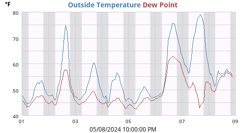
| Dew Point | 62.5°F |
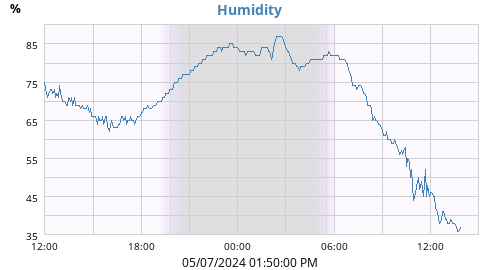
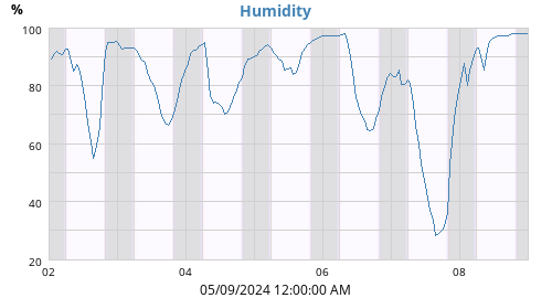
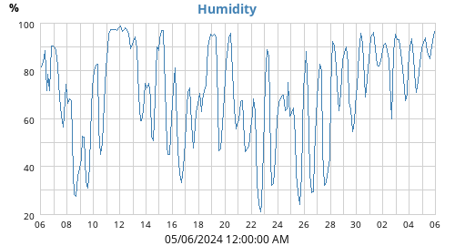
| Humidity | 64% |
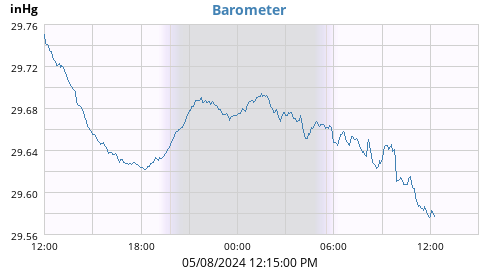
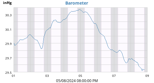
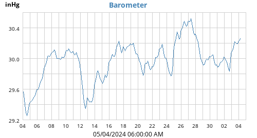
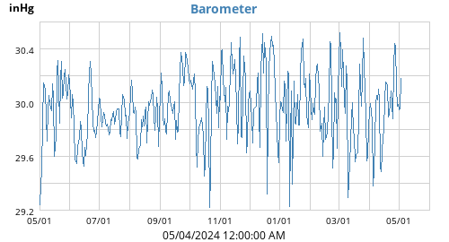
| Barometer | 30.112 inHg (0.027) |
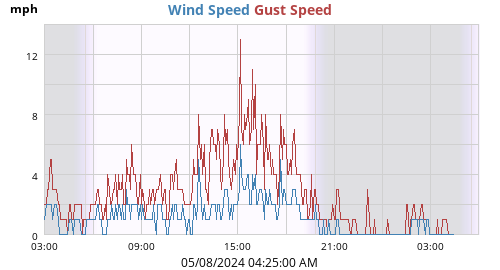
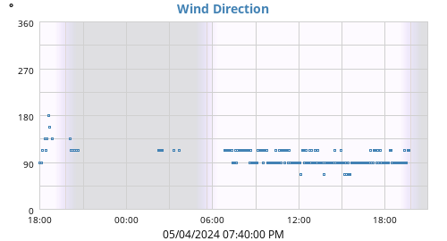
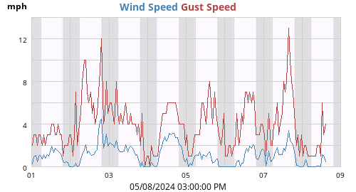
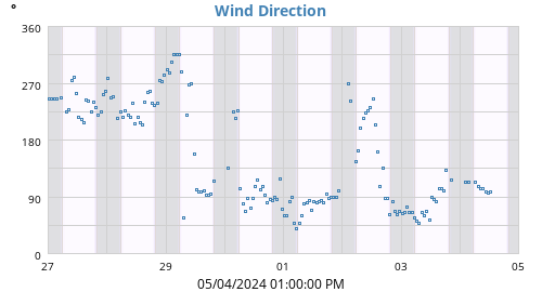
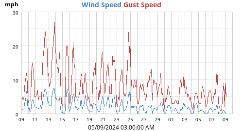
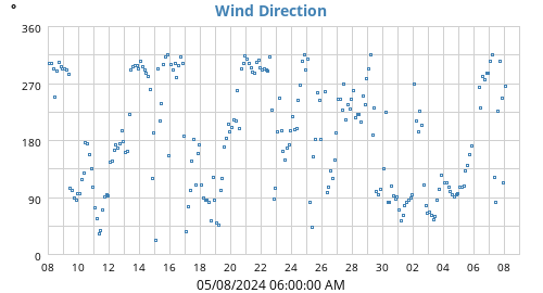
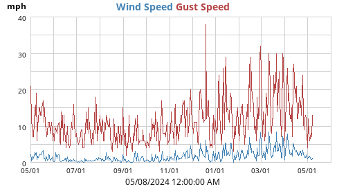
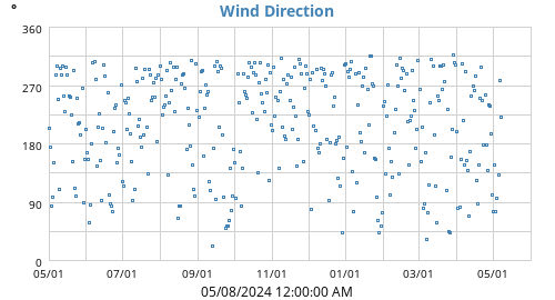
| Wind | 1 mph NE (45°) |
| High Wind | 3 mph from 321° at 08:18:13 AM |
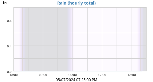
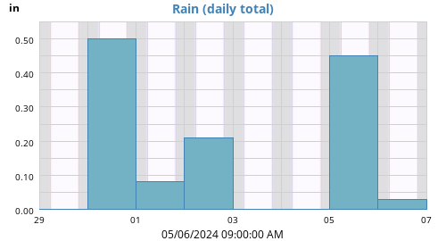
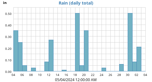
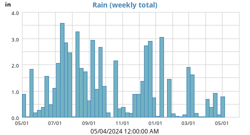
| Rain Today | 0.00 in |
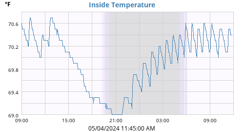
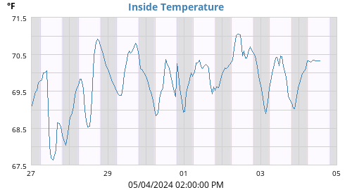
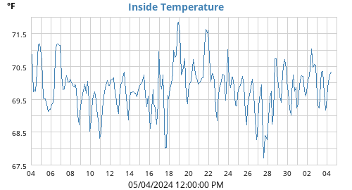
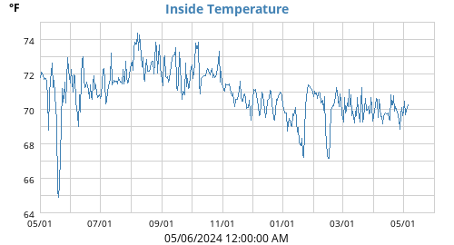
| Inside Temperature | 74.8°F |
| Weather Underground pages |
Dashboard KMAFRAMI6
Wundermap Daily Precipitation |
Radar
♦

| Today |
Week |
Month |
Year |
Rain Year |
||
|---|---|---|---|---|---|---|
| Outside Temperature |
75.7 61.1 |
86.1 61.1 |
95.0 58.6 |
96.2 11.2 |
96.2 11.2 |
°F |
| Heat Index | 75.7 | 91.3 | 111.0 | 115.8 | 115.8 | °F |
| Wind Chill | 61.1 | 61.1 | 58.6 | -4.2 | -4.2 | °F |
| Dew Point |
62.6 56.2 |
74.1 56.2 |
81.2 52.5 |
81.2 0.9 |
81.2 0.9 |
°F |
| Humidity |
85 63 |
98 42 |
99 33 |
100 18 |
100 18 |
% |
| Barometer |
30.113 30.061 |
30.170 29.904 |
30.242 29.664 |
30.596 28.928 |
30.596 28.928 |
inHg |
| Rain | 0.00 | 0.04 | 1.35 | 29.55 | 29.55 | in |
| Rain Rate | 0.00 | 0.04 | 21.33 | 655.35 | 655.35 | in/h |
| Wind Max |
3 321 |
11 323 |
16 287 |
45 292 |
45 292 |
mph ° |
| Wind Average | 0 | 1 | 1 | 2 | 2 | mph |
| Wind RMS | 1 | 1 | 1 | 3 | 3 | mph |
|
Vector Average Average Direction |
0 324 |
1 312 |
1 287 |
1 320 |
1 320 |
mph ° |
| Inside Temperature |
75.4 74.8 |
76.3 71.5 |
76.3 69.2 |
76.3 66.4 |
76.3 66.4 |
°F |
| ☀ | ☽ | |||
|---|---|---|---|---|
| Rise | 05:33:37 AM | Rise | 11:33:04 PM | |
| Set | 08:10:03 PM | Set | 12:58:34 PM | |
| Daylight | 14:36 | Last quarter 56% |
| Connectivity | |
|---|---|
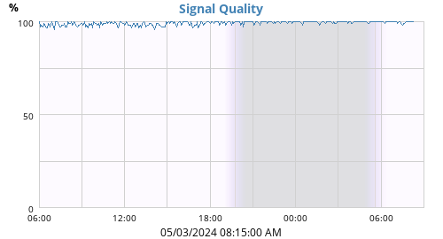
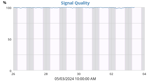
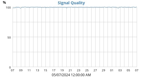
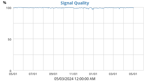
| Signal Quality | 97% |
| Battery Status | |
| Transmitter Battery | OK |
| Voltage | |
| Console Battery | 4.5 V |
| Hardware | Vantage Vue |
| Latitude | 42° 18.48' N |
| Longitude | 71° 24.30' W |
| Altitude | 265 feet |
| Server uptime | 25 days, 3 hours, 26 minutes |
| WeeWX uptime | 25 days, 3 hours, 24 minutes |
| WeeWX version | 4.1.1 |